Recently, we wrote that the Sutro Forest 2017 Plan Imposes a Landslide Risk. A University of Washington study shows that mudslides are most like 5-10 years after trees have been cut down on slopes. The picture below shows the South Ridge, which will be directly affected.

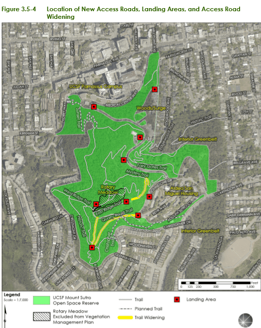
But it’s not just the tree-cutting. UCSF is widening two major trails into roads fit for heavy equipment, and adding nine quarter-acre “staging areas” for machines and felled trees. Both the roads are above Forest Knolls. (The heavy yellow lines in the map below are the new roads. The red squares are the locations of the staging areas, each of which will be a quarter acre.)
The picture at the top of this article gives some indication of how steep the hillside is. And the roads above Forest Knolls are atop a slope *known* to be unstable. Look at this landslide hazard map:
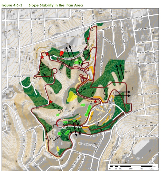
 The double black arrows show landslide direction. The wiggly black arrows show soil creep direction. All those dark green areas? Potentially unstable. All the gold areas? Also potentially unstable.
Though the Draft Environmental Impact Report claims it’s making safety its first priority – it doesn’t look like it. In attempting to mitigate one (overstated) concern (dead trees falling), they’re worsening the risk of landslides.
— ### —