This delightful tourist map from 1927 has been circulating on the Internet. It’s got a lot of fun detail. (Clicking on this map will make it larger.)
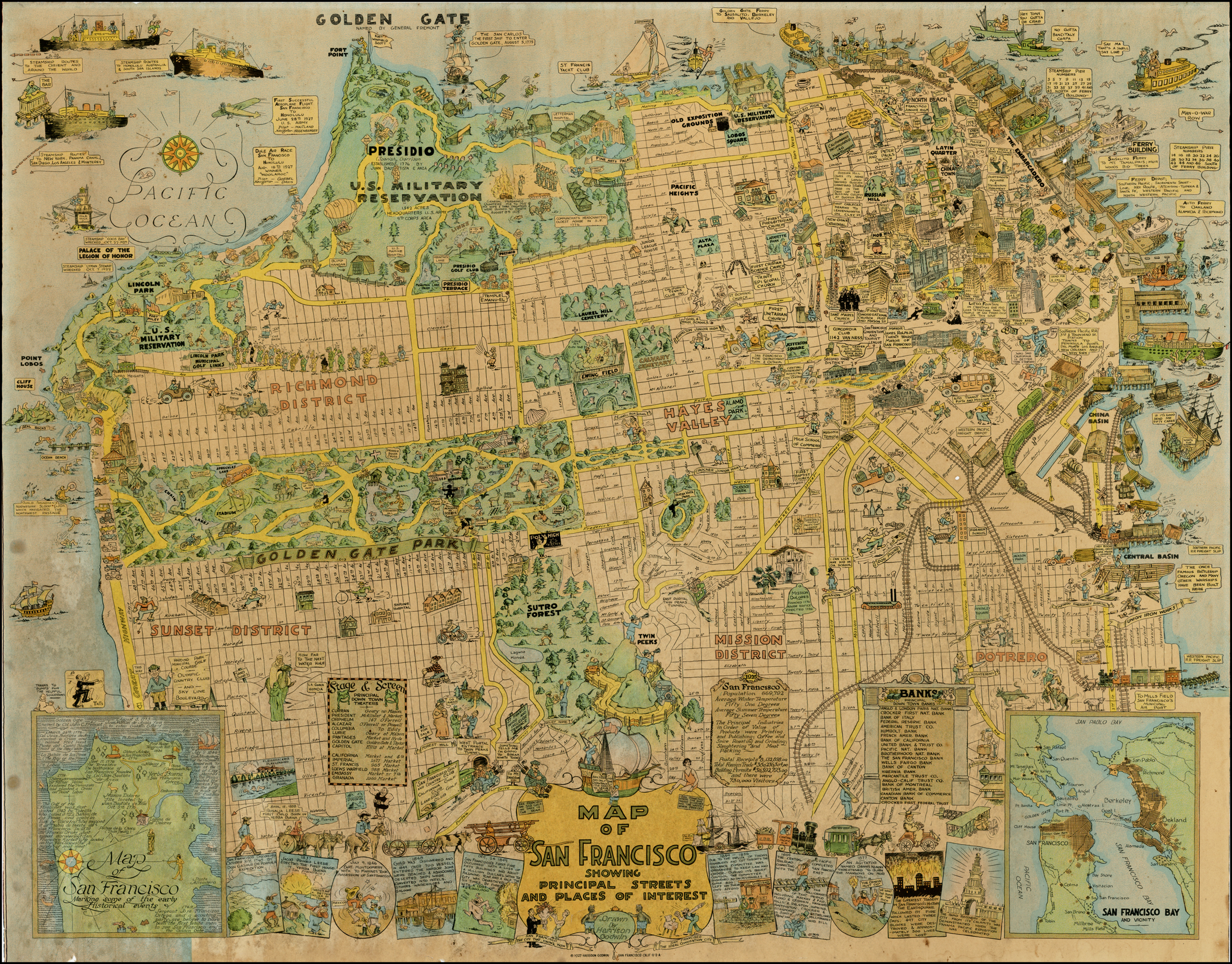 The RichmondSF blog researched the map, and had some interesting notes about the cartoons and what they referenced. The artist was Harrison Godwin, 1899-1984, and he created other cartoon maps including one for Hollywood.
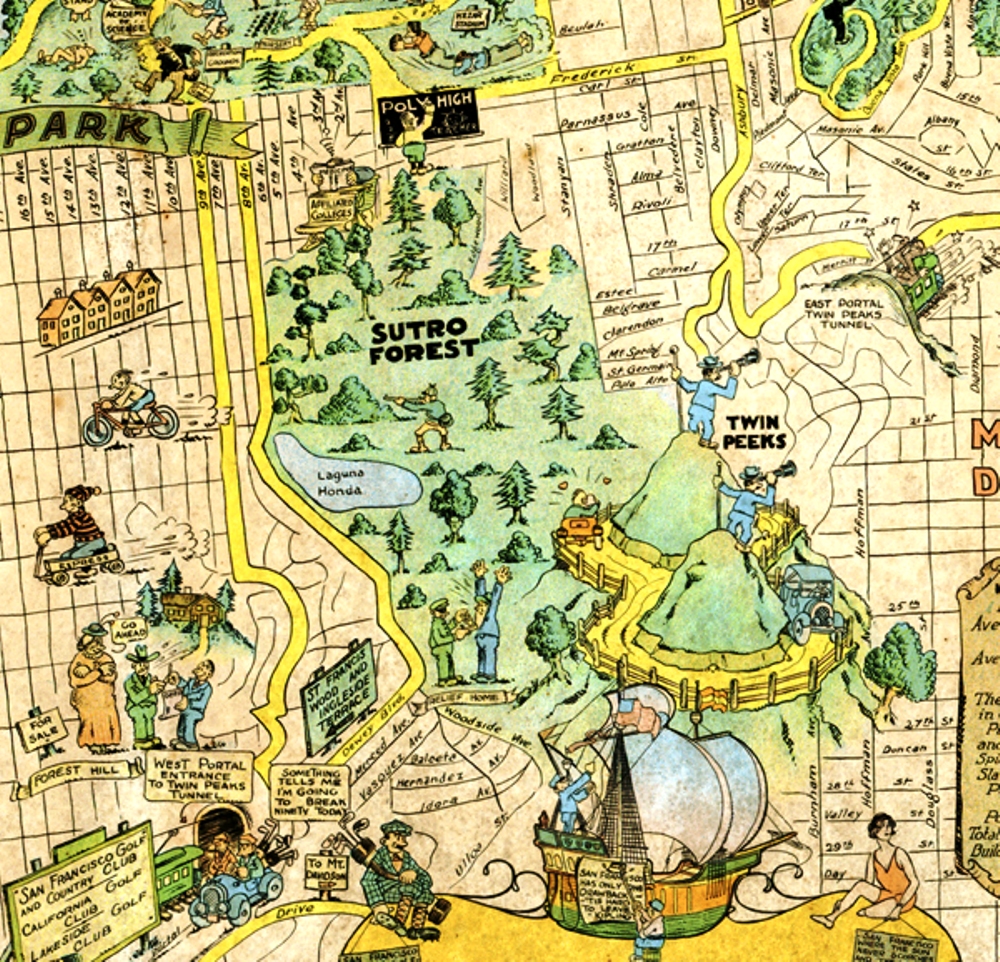
Sutro Forest is prominently displayed – with a hunter, and a hold-up, and Affiliated Colleges (which later became UCSF). That’s visible in the cropped and brightened version below.
If you’re interested in buying a copy of the map, reprints are available from David Rumsey Map Collection. Go HERE to access them on the web. They can do reproductions from 10 inches to 50 inches in size, and crop it if you want to.